RWIS is an optional service available within the Pavement Forecast Transportation, Transportation, Airport Operations and Alberta editions. Contact your sales representative for more details.
Hourly observed pavement or runway and bridge deck conditions are available from participating RWIS sites to help you provide the most cost-effective road maintenance for your area. RWIS does not provide forecast data.
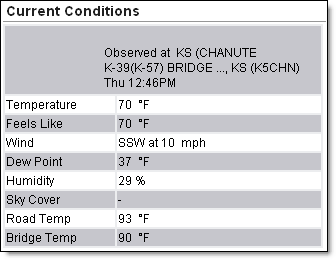
The Dashboard includes road and bridge or runway temperatures within the current conditions.
To view the RWIS data on the Dashboard select that site from the Choose a Location drop down menu. You must first create a location for the lat/lon of the RWIS site.
The RWIS observation layer is available under Map Layers on the Local Radar page.
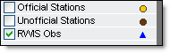
Additional layers of RWIS data are available under Weather > Observation Layers. These include: Precipitation Detection, Pavement Conditions, and Pavement Temperature.
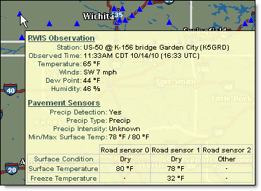
Use the Get Details feature to view additional data from the RWIS site.
![]()
Data availability will vary between sensors.
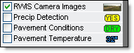
RWIS camera images are an optional purchase. Availability will vary between sensors.
If purchased, RWIS Camera Images are available under the Weather > Observation Layers.
While the RWIS Camera Images layer is loaded, use the Get Details feature to view additional information about the RWIS location.
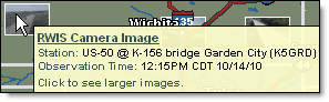
Click while the popup is visible to view a larger camera image from the RWIS site.
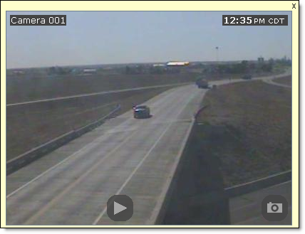
Camera images will not update in this state. Close the camera image popup using the X in the upper right and re-open in order to view new images. Click the Play icon to view a three hour loop. A new image is taken about every 10 minutes.
The pavement and bridge deck observed conditions are provided for up to the past 12 hours within the Hourly Forecast.
![]()
![]() MxVision WeatherSentry Online
MxVision WeatherSentry Online