
When your cursor is positioned over any one of the Menus they become visible, however after a period of inactivity the Menus will again become transparent. If you move your cursor off of the function menu it will become transparent more quickly.
|
|
If you are under administrator control your Account Administrator will determine your layered map defaults.
To view preferences hover over the small arrow next to radar in the Layer Settings menu.
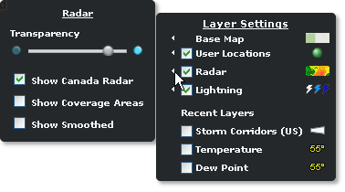
The slider enables visual adjustments to transparency while the layer is loaded.
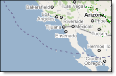
Canadian radar can be turned on/off in the radar layer preferences. Canadian radar provides a new scan every ten minutes. While viewing Canadian radar turn on the coverage area to determine the northern extent of Canadian radar.
In radar settings a check box provides an on/off choice to show the edge of the radar coverage.
When turned on, a blue dotted line depicts the edge of the US radar grid. The US radar grid includes the continental US, the US/Canadian border region of southern Canada, the majority of Alaska, the Hawaiian Islands, Puerto Rico, both the US and British Virgin Islands, and portions of the Bahamas and Cuba. If Canadian radar is selected for viewing, the dotted line will also include the coverage area over Canada.
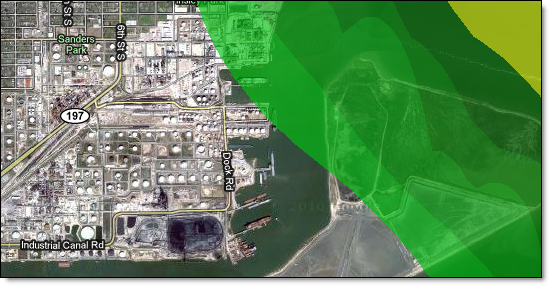
Smoothed radar viewed over high-resolution street-level mapping provides the ultimate view of operational conditions.
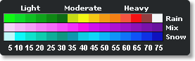
To view the radar legend, hover over the radar symbol in the Layer Settings menu.
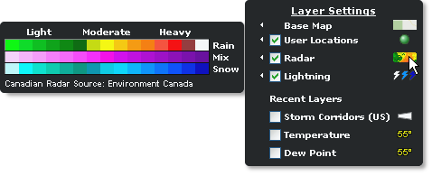
Note: Environment Canada is listed as a source when Canadian radar is turned on.
The radar legend including the corresponding dBZ levels.
![]()
![]()